Maps
When walking through Baltimore City, the segregation is stark. Effects from redlining and housing segregation means entire neighborhoods can be separated by a single street, often delineating shifts in race, culture, and income level. The major streets where this can be seen most clearly are North Avenue (running from east to west) and Greenmount Avenue (running from north to south).
Greenmount Avenue in particular provides a clear portrait. Like most other major streets in the city, it is unassuming— lined with small businesses, restaurants, thrift stores, and gas stations. It crosses through multiple neighborhoods, including Waverly, a working-class Black neighborhood, mostly populated with families. The east side of Greenmount Ave. is divided into typical residential blocks of rowhomes. On the west side of the street, are a variety of trees, fences, and pedestrian pathways. Stepping past the short brick columns that act as barriers along the two-way street, are acres of rolling green suburbs with two and three-story houses hidden from view.
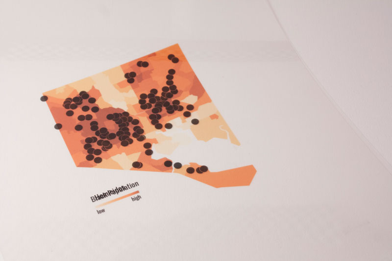
Redlining is a surreal experience that can be felt while walking and driving in the city. With the physical barriers erected by Baltimore City, it is strategically difficult to enter into the white neighborhood of Guilford while driving on Greenmount Ave. The first time I experienced this was with a friend while we were walking his dog from their home in Waverly. The transparency of these pieces aims to mirror the transparency of redlining in Baltimore.
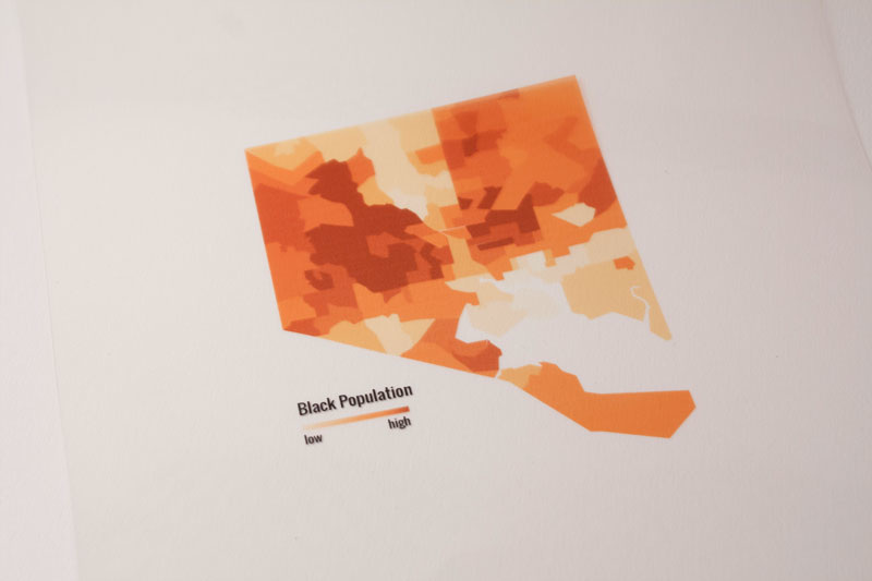
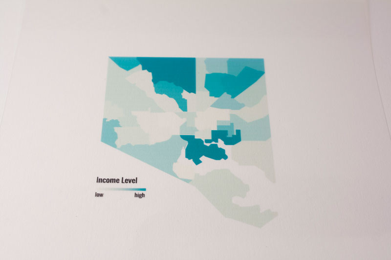
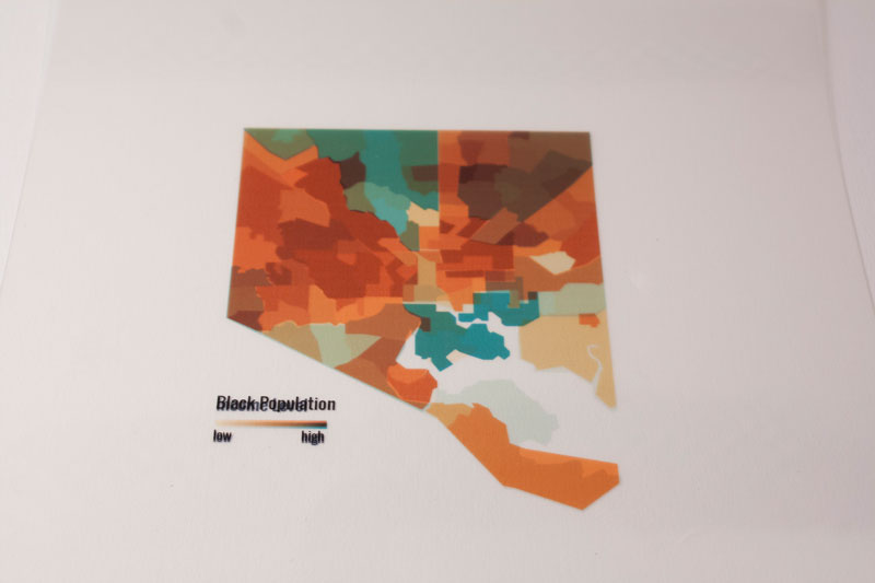
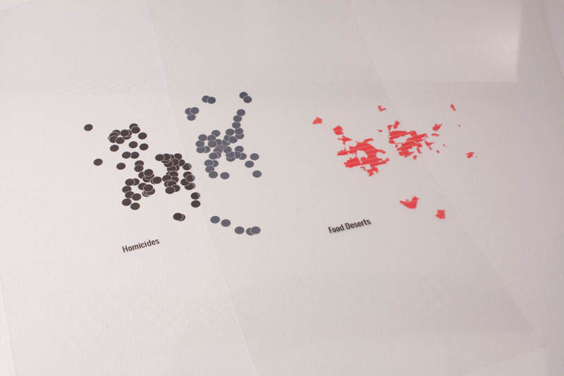
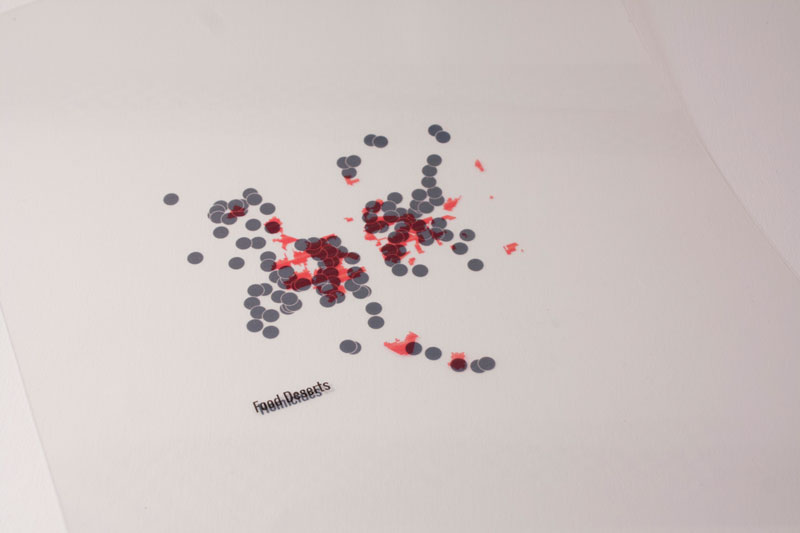
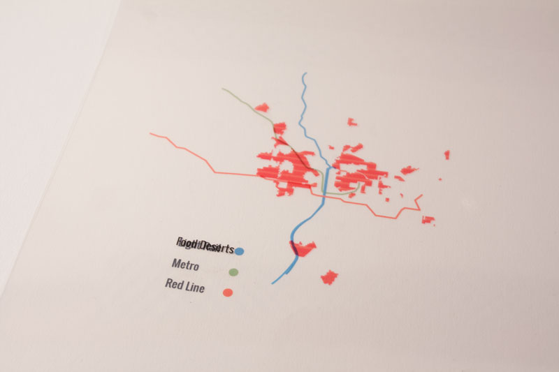
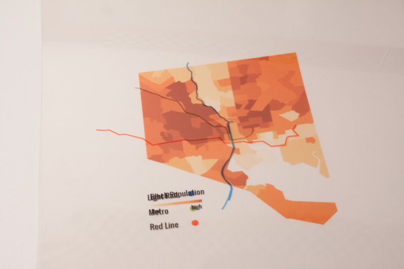
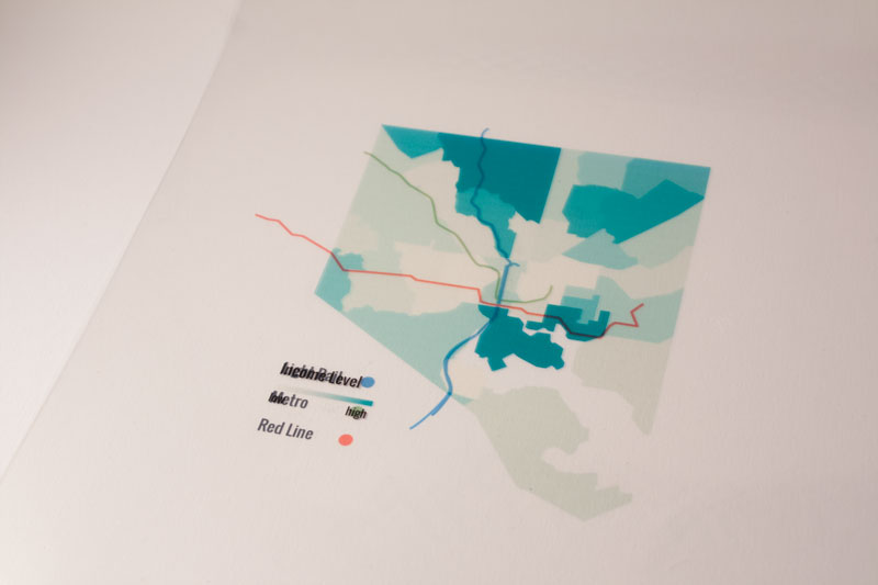
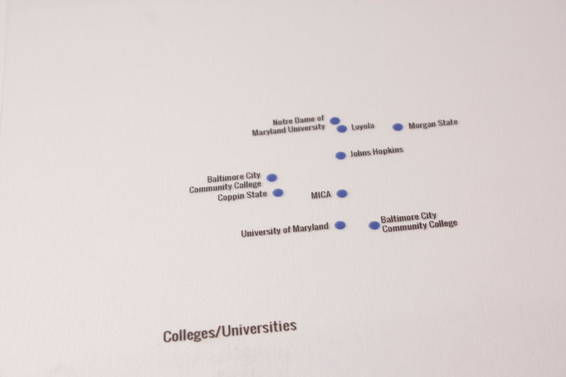
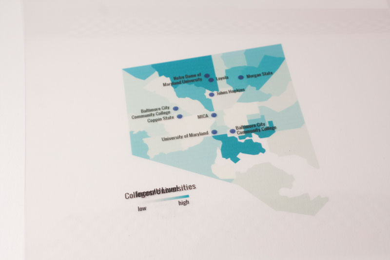
Using color to illustrate these divides, this project is based on 2013 census reports and research-based mapping.
For it, I recreated and printed the maps I found for each statistic and printed them on transparent sheets of paper. The sheets can then be overlaid, mixed and matched to see the correlations between location and opportunity, more specifically described as “The White L and the Black Butterfly”. In other words: Central Baltimore contains the wealth of the city, and East and West Baltimore is kept from it both physically and systemically. (2015)
“The Red Line was a planned east-west mass transit light rail line for Baltimore, Maryland. Although it had been granted federal approval to enter the preliminary engineering phase, Maryland Governor Larry Hogan declared on June 25, 2015 that he would not provide state funds for the project. The line's construction had been estimated to begin in late 2015–early 2016, subject to funding, with a completion date set for late 2021–early 2022.
The Red Line cancellation was briefly investigated by the U.S. Department of Transportation for being in possible violation of Title VI of the Civil Rights Act of 1964, however the investigation was closed with no finding of a violation.”
- Wikipedia contributors, "Red Line (Baltimore)," Wikipedia, The Free Encyclopedia